
Positions on the Earth's surface
Most people would be reasonably familiar with the idea of a street map and most street maps use coordinates, usually a letter and a number, to represent positions on the map.
Imagine however that we want to find a particular position on the Earth's surface. As we know, the Earth's surface is not flat like your street directory map, it's spherical. So instead of using letters and numbers, we use a system called longitude and latitude. The meridians of longitude and parallels of latitude create an imaginary grid on the Earth's surface. We use these 2 numbers to represent a position on the Earth's surface.
These numbers appear on things like your GPS (global positioning system) or in online map programs like Google Maps. Here, for example, is the global coordinate of the Sydney Harbour Bridge in Sydney, Australia.

The coordinate of the Sydney Harbour Bridge is $33.8523^\circ S$33.8523°S, $151.2108^\circ E$151.2108°E. But what exactly do these two numbers represent?
Longitude and latitude
Longitude is a measure of how far a position is east or west of the Prime Meridian. The Prime Meridian (which used to be called the Greenwich Meridian) is a special, imaginary line of longitude that is defined to be $0^\circ$0°. Another important line of longitude is the International Date Line (IDL), which has a longitude of approximately $180^\circ$180°, although it deviates slightly to avoid passing through certain countries and islands.
Whilst the lines of longitude are the vertical lines on the map, they are a measure of horizontal distance around the globe.
Latitude is a measure of how far a position is north or south of the Equator. The Equator is a special line of latitude that runs through the centre of the Earth that is defined as having a latitude of $0^\circ$0°. The lines of latitude are the horizontal lines on a map, but they are a measure of the vertical distance above or below the Equator.
We can see on the map below, that the middle of Australia is located at $20°S$20°S, $135°E$135°E. (Unlike grid reference systems, coordinates using longitude and latitude use the vertical position first)

These longitude, and latitude coordinates are what GPS systems use to locate your position on earth. The level of accuracy needed to pinpoint a particular person is of course a lot greater than that needed to identify the location of a country! Most common handheld devices like mobile phones that use a GPS are normally accurate to within $10$10 m.
Worked example
The world map below shows the lines of longitude and latitude. Several locations are marked on the map.

(a) Which point is located on the Prime Meridian?
Think: The prime meridian is the line where the E/W is measured from, it has value $0^\circ$0°
Do: The point that is on the vertical line marked with $0^\circ$0° is $A$A.
(b) Which location has coordinates of $30°$30°$S$S, $60°$60°$W$W
Think: The latitude is $30°$30°$S$S, this means $30°$30° south of the equator. Find the equator on the map, the central line that runs horizontally around the middle of the earth. then travel south of that till you hit $30°$30°.
The longitude is $60°$60°$W$W. This means that the position is west of the Prime Meridian. Find the Prime Meridian on the map and then travel west of that till you get to $60°$60°$W$W.
Do: The location with coordinates of $30°$30°$S$S, $60°$60°$W$W is $F$F.
(c) Find the coordinates of point $I$I.
Think: Start by identifying the latitude. How far above or below the equator is the point? If it is above the equator then the point is north of the equator if it is below than the point is south.
Then you identify the longitude. How far left or right of the Prime Meridian is the point? If it is left, then we say the point is west of the Prime Meridian, if it is to the right we say the point is east of the Prime Meridian.
Do: Point $I$I is north of the equator, it is sitting on the $60°$60° line, so it has latitude $60°$60°$N$N.
Point $I$I is east of the Prime Meridian, it is sitting on the $120°$120° line, so it has longitude $120°$120°$E$E.
Put these together and we have the coordinates of $I$I, $60°$60°$N$N, $120°$120°$E$E.
(d) How many degrees south is point $C$C from point $B$B?
Think: To answer this we need to know how many degrees difference there is in the latitude.
Do: $B$B is on latitudinal line $15°$15°$N$N and $C$C is $15°$15°$S$S.

The difference is $15°+15°=30°$15°+15°=30°.
(e) How many degrees east is point $C$C from point $F$F?
Think: To answer this we need to know how many degrees difference there is in the longitude.
Do: $F$F is on longitudinal line $60°$60°$W$W and $C$C is $90°$90°$E$E.
The difference can be found by thinking of it this way

The difference is $60°+90°=150°$60°+90°=150°.
Practice questions
Question 1
Several locations are marked on the map below.
Which location has the same latitude as $G$G?
$\editable{}$
Which location has the same longitude as $D$D?
$\editable{}$
Question 2
Using the map, what is the latitude and longitude of Darwin?
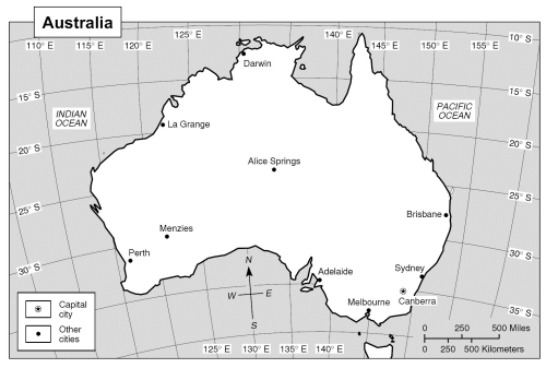
$13^\circ$13°South, $130^\circ$130°East.
A$120^\circ$120°South, $130^\circ$130°East.
B$13^\circ$13°South, $130^\circ$130°West.
C$130^\circ$130°South, $13^\circ$13°East.
D
Question 3
Town A is $7^\circ$7° south and $10^\circ$10° west of town B. If town B’s position is $25^\circ$25°N, $154^\circ$154°E, what is town A’s position?
$15^\circ$15°N, $147^\circ$147°E
A$18^\circ$18°N, $144^\circ$144°E
B$18^\circ$18°S, $144^\circ$144°W
C$32^\circ$32°N, $164^\circ$164°E
D